On Thursday of last week, I took off for southwestern Utah to spiff up my photo collection on Utah's national parks and monuments -and nearby state parks.
I went from Salt Lake to Cedar Breaks National Monument, Zion National Park, Bryce Canyon National Park, Kodachrome Basin State Park, Escalante, Grand Staircase-Escalante National Monument's Smokey Mountain and Hole in the Rock roads, Devil's Garden, UT 12 and its Hog's Back Section, the Escalante River Trailhead, Lower Calf Creek Falls, Petrified Forest State Park, Boulder, Boulder Mountain and Boulder Mountain National Forest, Torrey, and Capitol Reef National Park.
In order to see all of this and get a lot of new off-road photos and vistas, I had time only to run these trails with my camera in a ziplock bag; walking would have been too slow! It was incredibly fun, but draining as well...
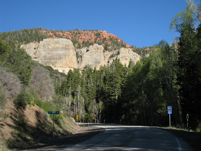
 Driving up canyon from Panguitch toward Brian Head Resort and Cedar Breaks National Monument.
 The final and steepest/ most exposed pitch of the Angel's Landing Trail. Amazingly, a significant number of the people at the top were in their 60s and 70s.
 Leaving Zion National Park on UT 9/ Zion-Mt Carmel Highway. The beautiful slick rock is much different than the deep canyons to the west.
 Hanging gardens at Lower Calf Creek Falls (between Escalante and Boulder), Grand Staircase-Escalante N.M.
 UT 12 meandering its way up slickrock
 In Petrified Forest State Park, a non-petrified plant
 A petrified LOG
 The reservoir of the Petrified Forest State Park in Escalante as viewed from the hiking trail. I swam in this to rinse off after two days of running.
 The Hog's Back section of UT 12 between Escalante and Boulder
 Ascending Boulder Mountain
 Boulder Mountain sits high, high up above the surround red rock country


Great pics, and it sounds like a very tough trip!
ReplyDeleteIt was fun! I'm definitely still tired. And I believe the car is, too...
ReplyDelete