 FIRST DAY OF FREEDOM:
IT'S BEEN A LONG SPRING. I've moved more than once, surfed couches, worked extra hard, packed my stuff, stored it in friends' basements, (gone back into those basements to retrieve stuff I've prematurely stored,) lost my wallet, lost my mind, found both...

Also, the last month has been completely devoid of climbing. My joints and muscles were creaking, crunching, and genearlly losing steam. Knowing well that I'm injury-prone, I decided it wouldn't be a bad idea to give 'em a rest. It also turns out that I was so freaking busy recently, there really wasn't time to climb anyway. So I now head into three months of climbing all rested and recovered! A bit softer than before, but whatever... There's some battles you just can't fight.

..
Yesterday, Friday, May 29 was my first official day of this grand summer... I will be working on two books this summer- but don't have any scheduled work until Sept.

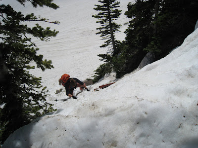
I had one free day in SLC before work, and before leaving for the summer. My friend, Ed, and I had planned to climb on Friday, time permitting. As per our epic-seeking tendencies (see most recent post, below), we decided to not only try for a long, pretty hard multipitch route, but one that would require hours of approaching. Because this particular route tops out at something like 10- or 11,000 feet, much of the approaching would be in serious snow and would require skinning and skiing.

So we got dressed and loaded our bags for a yuppie extravaganza:
Hiking Gear (check)
Ski Touring Gear (check)
Rock Climbing Gear (freakin' check!)
The only thing we were missing was a mountain bike tied to a kayak. With a hemp rope.

Anyway. To confess: we did not even reach the base of the climb. Our goal was to climb Hogum's Heroes (5.11D, 6 [LONG] pitches) at the top of Hogum's Fork drainage in Little Cottonwood Canyon. But...

It turns out that in springtime after a super-duper snowy winter, the river is FULL! (?) Yes. LCC River = Swift DEATH right now. So... we had to start the approach much farther north in LCC, rather than at the base of Hogum Fork drainiage.

We thought we'd cleverly use a bridge and trail to ascend into Red Pine Basin and just "go up and over a couple of ridges and we'll be right there!" Turns out that once again we got suckered by benign-looking contour lines again on the freindly-looking topo map... Again! (Again: see below post.) Those "little countour lines" actually depict freaking MOUNTAINS covered in freaking ROCKS and SNOW!

The real nail in the plan's coffin was that we had taken a wrong turn early on the hike that took us into White Pine Basin (yet one farther north of Hogum's Fork than Red Pine)... so we basically had no chance of reaching the route on time- far too many rocky, rocky spines, steep slippery snow traverses, miles of seperation, and feet of elevation gain and loss.

But the good news is: We had a hell of a day of ski touring (my first and presumably only ski day of the year), and I got to see Ed try to ski his split board down. Funny stuff that Ed Lyman split-board snow plow! Also, I got to see the Wasatch Mountains in a way I haven't in a long time... they're truly incredible. And, as with our last mountain epic (below post), Salt Lake City was often in plain view.

No comments:
Post a Comment